
A parcel is a legally defined unit of land with fixed boundaries, a unique identifier, and recorded ownership. Think of it as a specific “slice” of property that’s officially separated from surrounding land and recognized by your county as a distinct legal entity.
If you’re buying land, selling a home, or navigating rural real estate in north Georgia, understanding parcels is essential. They’re the foundation of every property transaction, tax assessment, and zoning decision. Let’s break down what they are and why they matter to you.
The Legal Definition of a Parcel
In legal and real estate terms, a parcel is a contiguous piece of land described and identified in official county records. It has clearly marked boundaries, a recorded owner, and a unique parcel number assigned by your county assessor.
Related: What Is Proration in Real Estate? Complete Guide
Related: What Is Ad Valorem in Real Estate? Complete Guide
Related: What is Sub Agency in Real Estate? A Clear Guide
Each parcel is treated as an individual property unit for taxation, legal, and transactional purposes. You can’t buy half a parcel or claim ownership of a parcel without that ownership being formally recorded at the county level.
This legal clarity is what makes real estate transactions possible. Without parcels, nobody would know where one property ends and another begins.
How Parcels Are Identified
Every parcel gets a unique parcel number (also called a parcel ID or property ID) from your county assessor’s office. This number is the official identifier for that specific piece of land.
In Dawson County and along the GA-400 corridor, where Beautiful Homes Group specializes in rural and semi-rural properties, parcel numbers are essential for research. When you’re evaluating raw land or acreage, that parcel number connects you to:
- Ownership history and title records
- Tax assessment information
- Zoning and land use classifications
- Utility availability (septic, well, county water)
- Soil conditions and environmental reports
- Deed restrictions or easements
You can search your parcel number through the county assessor’s website or property tax records to find most of this data yourself.
Understanding Parcel Boundaries
A parcel’s boundaries are officially surveyed and recorded. They’re shown on plat maps (also called survey maps) filed with the county, and they define exactly where your property starts and stops.
Boundaries matter because they determine:
- How much land you own
- What you can legally use the land for
- Whether you have road access or utility access
- Your property taxes (based on acreage and assessed value)
- What building or development is allowed
In rural areas, boundaries can follow natural features like creek lines, roads, or ridges. In subdivided land, they’re typically straight lines marked by survey stakes or monuments.
How Parcels Are Created and Subdivided
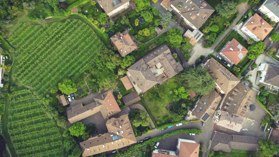
A parcel starts as part of a larger piece of land. When an owner decides to sell or divide their property, they hire a surveyor to create a formal subdivision. This subdivision splits one large parcel into multiple smaller parcels, each with its own parcel number and boundaries.
In Dawson County, this subdivision process requires county approval and compliance with local zoning and development codes. Each new parcel must meet minimum lot size requirements, which vary by zoning district.
For example, a 10-acre parcel in a rural zone might be subdivided into four 2.5-acre parcels, each becoming its own legally independent property.
Why Parcel Information Matters to You
If you’re buying a home or land, your purchase contract specifies the exact parcel number. Your deed (the legal document proving ownership) describes the parcel by reference to that number and its recorded survey.
When you get a mortgage, the lender pulls parcel records to verify the property exists, is legally described, and can be assessed. Property taxes are calculated based on parcel assessments. Zoning compliance is determined at the parcel level.
For rural property buyers, parcel records reveal critical details: whether the land is served by county water or requires a well, whether it’s on a septic system or needs a septic permit, and whether utilities like natural gas or broadband are available.
Understanding your parcel’s characteristics before you buy is how you avoid expensive surprises after closing.
How to Find and Search Your Parcel
Most county assessor offices maintain online parcel search systems. To find your parcel, you typically need:
- Your property address
- The owner’s name
- Your parcel number (if you already have it)
Search the Dawson County assessor’s website or your county’s property tax portal. You’ll find the parcel number, current owner, assessed value, tax amount, and sometimes zoning information and parcel maps.
If you’re evaluating land to buy, the parcel search should be your first step. It answers foundational questions about what you’re actually purchasing.
Parcels and County Records

County records are the source of truth for parcel data. The assessor maintains parcel records for tax purposes. The register of deeds office records ownership changes and deed transfers. The planning and zoning department tracks zoning classifications and development restrictions.
When you search homes for sale through Beautiful Homes Group, every listing includes county parcel data because that’s how properties are legally identified and distinguished from one another.
Buying or selling?
These records are public, and you can access them for free or at a small cost through your county offices or online portals.
Parcels, Subdivisions, and Zoning
Zoning regulations control what you can do with a parcel. A parcel zoned for agricultural use can’t be developed as a residential subdivision without a zoning change. Minimum lot size requirements often prevent you from subdividing a parcel below a certain acreage.
In rural areas along the GA-400 corridor, zoning is often more permissive than in suburban zones, allowing larger acreage parcels for owner-builder development, hobby farms, or equestrian use.
But zoning can also impose restrictions: some parcels may have deed restrictions (private covenants) that limit building type, number of units, or land use regardless of what the county zoning allows.
Practical Steps When Buying or Selling a Parcel
Before you make an offer on land or a home:
- Search the parcel number in your county assessor records
- Review the parcel map to confirm boundaries and size
- Check zoning classification and any development restrictions
- Verify utility availability (county water, septic, well, electricity, internet)
- Request a title search to confirm ownership and identify any liens or easements
- If the parcel is subdivided or will be, hire a surveyor to verify boundaries
These steps are especially critical in rural real estate, where soil conditions, topography, utility infrastructure, and zoning heavily influence what the land is worth and what you can legally do with it.
When you’re ready to move forward with a purchase, working with real estate professionals who understand county records—like Beautiful Homes Group, which specializes in detailed county research for rural and semi-rural properties—can save you months of confusion and thousands of dollars in unexpected costs.
Key Takeaways About Parcels
A parcel is a legally defined, officially recorded unit of land with a unique identifier, fixed boundaries, and documented ownership. Every real estate transaction, tax assessment, and zoning decision depends on parcels to define exactly what property is involved.
Understanding your parcel—its boundaries, zoning, utilities, and recorded ownership—is the foundation of smart real estate decisions. County records are free and publicly available, so take the time to research before you buy.
Whether you’re purchasing raw acreage, a rural home, or evaluating land for development, parcel knowledge protects your investment and clarifies what you’re actually getting.
Questions About Parcels? We Can Help
If you’re buying or selling property in Dawson County or the GA-400 corridor and need guidance on parcel records, zoning implications, or utility infrastructure, Beautiful Homes Group offers bilingual representation and detailed county records research to clarify exactly what you’re purchasing or selling.
What’s the difference between a parcel and a lot?
A lot is a parcel of land, usually in a platted subdivision. The terms are often used interchangeably. A “lot” typically refers to a smaller residential parcel in a planned development, while “parcel” is the broader legal term for any legally defined unit of land.
Can I own part of a parcel?
Legally, no. Ownership is recorded at the parcel level. If you want to own half of someone’s land, that land must first be subdivided into two parcels with separate parcel numbers and deeds. Then you can own one of those new parcels.
How do I find my parcel number?
Search your county assessor’s website by address or owner name. The parcel number (also called parcel ID) will appear in the results. You can also find it on your property tax bill or property deed.
Can a parcel be split without surveying?
No. Subdividing a parcel requires a licensed surveyor to create a formal plat map, which must be filed with the county. This ensures boundaries are accurate and each new parcel is legally valid. The county must approve the subdivision plan before lots can be sold.
Buying or selling?