
Dawsonville
A factual overview of housing, land conditions, and local infrastructure in Dawson County.
Housing Stock and Development
The housing stock in Dawson County has a median year built of . Recent residential construction activity is indicated by new residential permits issued countywide. Local historic structures include the Dawson County Courthouse and the Gilleland, Boyd and Sallie, House, both listed on the National Register of Historic Places.
Soil and Environmental Factors
When planning residential construction or purchasing property in Dawsonville, soil and flood factors must be evaluated. Soil surveys indicate that 99.1%1 of the rated acreage is classified as limited for septic tank absorption fields. Additionally, flood risk assessments show that special flood hazard zones are present, specifically Special flood hazard zones present: A2. The Dawson Forest Wildlife Management Area is a major natural landmark in the county.
- Mapped as limited for septic
- 99.1% 1
- Share of rated acreage classed somewhat limited or very limited for septic tank absorption fields, SSURGO major components, weighted by map unit acreage. Map unit acreage is survey-area wide, so treat this as indicative of the soils present rather than an exact share of this area.
- FEMA flood zones present
- Special flood hazard zones present: A 2
- Distinct flood zone designations intersecting the area envelope, FEMA National Flood Hazard Layer.
Local Infrastructure and Services
Local infrastructure in Dawsonville includes retail and dining options. The nearest grocery option is Food Lion, 0.5 miles3. Dining establishments in the vicinity include El Rio, Aunt Dyann's, Old Towne Pizza, Big D's BBQ & Biscuits, DQ Grill & Chill, The Station House3. For recreation, residents have access to parks such as Veterans Memorial Park, Rock Creek Park, Umbrella Court, Trellis Court, Sculpture Court, Children's Court3. Public transportation is not widely available, with None mapped within 5 miles3.
- Nearest grocery
- Food Lion, 0.5 miles 3
- Nearest mapped location in OpenStreetMap, straight-line distance from the area centre.
- Places to eat nearby
- El Rio, Aunt Dyann's, Old Towne Pizza, Big D's BBQ & Biscuits, DQ Grill & Chill, The Station House 3
- Named places to eat in OpenStreetMap within 5 miles of the area centre, nearest first. 9 mapped in total.
- Parks and protected land
- Veterans Memorial Park, Rock Creek Park, Umbrella Court, Trellis Court, Sculpture Court, Children's Court 3
- Named parks and protected land in OpenStreetMap within 9.9 miles of the area centre, nearest first. 24 mapped in total.
- Public transport stops within 5 miles
- None mapped within 5 miles 3
- No public transport stops recorded in OpenStreetMap within 5 miles of the area centre.
Racing History and Annual Events
Dawsonville has a documented history connected to stock car racing and moonshining. Notable racing figures from the area include Bill Elliott, Chase Elliott, Casey Elliott, Gober Sosebee, Roy Hall, and Spencer Davis. The researcher Raymond G. Grogan also has ties to the area. Annual events in the community include the Mountain Moonshine Festival, which features a parade, car show, and vendors. Other seasonal events include the Burt's Pumpkin Farm Fall Season and the Uncle Shuck's Corn Maze and Pumpkin Patch.
Photographed nearby
-
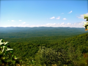
Amicalola Falls State Park, Georgia jeffgunn · CC BY · Wikimedia Commons -
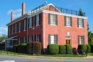
Dawson County Courthouse, Courthouse Sq. Dawsonville Gwringle · CC BY-SA · Wikimedia Commons -
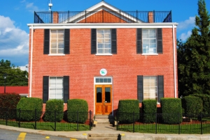
Dawson County Courthouse, Courthouse Sq. Dawsonville Gwringle · CC BY-SA · Wikimedia Commons -
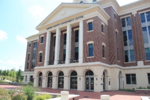
Dawson County Courthouse Thomson200 · CC0 · Wikimedia Commons -
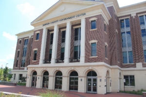
Dawson County courthouse, Dawsonville, Georgia, USA Thomson M · CC BY · Wikimedia Commons -

Dawson County courthouse, Dawsonville, Georgia, USA Thomson M · CC BY · Wikimedia Commons
Places nearby
- Dawson Forest Wildlife Management Area park in Dawson County, Georgia, United States of America Wikidata
- Dawson County Courthouse Listed on the National Register of Historic Places. National Register of Historic Places
- Gilleland, Boyd and Sallie, House Listed on the National Register of Historic Places. National Register of Historic Places
People from here
- Bill Elliott American racecar driver and team owner Wikidata
- Chase Elliott American stock car racing driver Wikidata
- Casey Elliott American stock car racing driver Wikidata
- Gober Sosebee racecar driver (1915-1996) Wikidata
- Roy Hall American moonshiner and stock car racing driver Wikidata
- Spencer Davis American stock car racing driver Wikidata
- Raymond G. Grogan American researcher of plant pathogens Wikidata
What happens here each year
- Mountain Moonshine Festival An annual festival celebrating Dawsonville's history with moonshine and stock car racing, featuring a parade, a massive car show, and hundreds of food and craft vendors. Usually held in October. Web search via Gemini — unverified
- Burt's Pumpkin Farm Fall Season An annual autumn event where visitors can experience hayrides, a massive pumpkin patch, and local fall treats. Usually held in September. Web search via Gemini — unverified
- Uncle Shuck's Corn Maze and Pumpkin Patch An annual fall attraction featuring a 15-acre corn maze, pumpkin patch, bonfires, and family activities. Usually held in September. Web search via Gemini — unverified
Questions people actually ask
- What public schools serve Dawson County?
The public schools in the county include .
- What are the soil conditions for building in Dawsonville?
Soil mapping shows that 99.1%1 of the rated acreage is classified as limited for septic tank absorption fields.
- What transit options are available in the area?
Public transportation is limited, with None mapped within 5 miles3.
- What historic properties are located in Dawsonville?
Historic properties in the area include the Dawson County Courthouse and the Gilleland, Boyd and Sallie, House, both of which are listed on the National Register of Historic Places.
See what is for sale here
Current listings are served from the MLS and update through the day.
- Homes for sale in Dawsonville Everything currently listed within about 15 miles of the area centre.
- Land and acreage near Dawsonville Lots and land, cheapest first.
- Larger parcels, one acre and up Septic systems need room. This filters to parcels with it.
- Just listed here Added in the last fortnight.
- Widen to all of Dawson County Rural areas can have nothing listed inside a few miles. This drops the boundary.
Sources
Every figure on this page is attributed to the record that issued it, with the date the record was read. Nothing here is estimated from listing data unless labelled as an estimate.
- Soils — USDA NRCS Soil Data Access (SSURGO) Dawson County read Aug 14, 2026 candidate
- Flood — FEMA National Flood Hazard Layer Dawson County read Aug 14, 2026 candidate
- Healthcare — OpenStreetMap (Overpass) Dawson County read Aug 14, 2026 candidate